Maps are instruments of knowledge, science, and faith. One trusts the ability of the mapmakers and their associates to measure the terrain accurately, and then to render on paper what exists in three dimensions. Also, one has to trust their motives for making a map; are they honest or expedient?
For a long time people imagined or invented places at will, for whatever purpose, filling the gaps at will or whim, and it took us time, in some cases centuries, to separate fiction from fact.
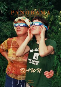
Our issue, Dawn, centers on new beginnings, the moment when darkness lifts and the scene is bathed in light, revealing what was hidden from view. The following excerpt, from a book titled Imaginary Peaks, by Katie Ives, is a fascinating introduction to the world of maps, cartography, and the visions, adventures, and sometimes wild imaginations that accompany the practice–a saga on a craft that will remain relevant for as long we seek out new terrains, on this planet and beyond.
At the start of the book, Ives recounts the story of the Riesenstein Hoax of 1962, when a group of conspirators created a fake mountain range and passed it off as real—complete with a fictitious history, an imaginary map, and a deliberately mislabeled photo—in Summit magazine.
– Nicolas D. Sampson
Chapter 1
It might seem astonishing to modern readers that a group of climbers could pass off a fake range as a real one as late as the 1960s. From their own reading of mountain literature, however, the Riesenstein hoaxers would have known just how easy it would be. The history of exploration has long been—and still is—formed partly by myths, errors, and fabrications. Illusory places continue to be un-discovered even during our present millennium. In 2012, scientists aboard the Australian ship RV Southern Surveyor sailed into a remote part of the South Pacific northwest of New Caledonia [i]. When they noticed that several authoritative sources, including Google Earth, indicated a landform ahead of them, they were surprised. Their hydrographic charts and depth soundings showed nothing there. Gliding past this purported “Sandy Island” at night, geoscientist Maria Seton saw only the darkness of an empty sea and the brilliance of undimmed stars. Various forms of this phantom island had existed on maps for centuries. In 1774, Captain James Cook sketched it as a long, delicate squiggle. In 1876, the crew of the whaling ship Velocity moved it farther east, depicting it as “a line of sandy islets . . . along the meridian 159°57′ E., between lat. 19°7′ S., and 19°20′ S.” Nautical charts stopped including Sandy Island after the French Naval Hydrographic and Oceanographic Service reported no sign of it during a 1979 aerial reconnaissance [ii]. But the landform reemerged on digital maps, which derived some of their information from older cartographies. It took the 2012 report of the Southern Surveyor to remove it once and for all.
In our Information Age, many of us have grown accustomed to illusions of technological omniscience. It’s easy to forget that mapmaking is still an act of metaphor, turning complex, multidimensional places into flattened, simplified, and conventional symbols. As cartographic historian J. B. Harley wrote in The New Nature of Maps, “far from holding up a simple mirror of nature . . . maps redescribe the world . . . in terms of relations of power and of cultural practices, preferences and priorities. What we read on a map is as much related to an invisible social world and to ideology as it is to phenomena seen and measured in the landscape.” From its earliest days, human depictions of geography have developed along a shifting threshold between the physical and the speculative, reflecting the influence of legends, approximations, and subjective choices.
Maps of imaginary peaks existed for millennia around the boundaries of cartographers’ familiar worlds. A Babylonian clay tablet, more than 2,600 years old, hints at voyages, undertaken or dreamed, through real and mythic alpine regions. Known areas of Babylon, Susa, Bit Yakin, Habban, Urartu, Der, and Assyria appear within a ring that indicates the ocean. An unnamed summit lies at the top. Beyond it, triangles symbolize unknown outer lands, such as one region where “the Sun is hidden and nothing can be seen” or another one “beyond the flight of birds [iii].”
The Guideways Through Mountains and Seas—compiled by Chinese writers mainly between the fourth century BC and the first century AD—is one of the first comprehensive guidebooks to fantastical ranges, listing hundreds of peaks with magical flora and fauna. Among them, Shaking Mountain, speckled with cinnamon and jade, contains the confusion-mulberry, a glowing, black-veined plant that heals mental confusion in anyone who wears a piece of it. Mount Winding-Center is home to a unicorn-like creature with a black tail and sharp claws who rips apart tigers and leopards for food. The ear-rat roams through the ruddy haze of the Cinnabar-Smoke Mountain. Shaped like a rat, with the head of a rabbit and the body of a deer, it howls like a dog and uses its tail like a wing. This beast also provides immunity against poison [iv].
Similar chimerical ranges jutted above distant oceans in the dreams of ancient Greeks. To the far North, the colossal summit of Saevo sparkled in the light of a never-setting sun, past islands where people had hooves for feet or ears that draped across their bodies like soft robes. Around 360 BC, in Plato’s Dialogues, the Greek philosopher Socrates depicted a shining red citadel that rose from the island of Atlantis, surrounded by peaks “celebrated for their number and size and beauty.” For many years, he said, local inhabitants lived virtuous and idyllic lives, until they became greedy and power-hungry, and the island sank beneath the waves [v]. Many scholars think that Atlantis was never meant to be an actual place. As historian Murat Cem Mengüç notes, such tales represent an early form of “paradoxography,” an allegorical story about a remote, imaginary country that offers an alternative vision of human societies [vi]. Nonetheless, spectral outlines of Atlantis and other lost continents have reemerged many times in exploration history, sought after by adventurers who continue to speculate that these places might once have been real.
During the fourth century BC, Greek explorer Pytheas allegedly reached one of the imagined countries, Thule, another realm of twenty-four–hour light, “six days’ sail north from Britain and near the Frozen Sea.” In his Natural History, completed around 77 AD, Roman philosopher Pliny the Elder called it the “most remote” of any land. Geographers and historians still argue over whether the account of Pytheas’s voyage was a hoax or whether Thule was an identifiable region somewhere in Scandinavia or the Arctic, real lands of the midnight sun. Like the legend of Atlantis, the symbolism of Thule has endured, refracting over centuries to reflect various fears and desires, at times horrifying or idyllic, an icy blank glittering just beyond the reach of mapmakers, an emblem of some ultimate mystery. A real mountain in Alaska now bears the name of “Ultima Thule Peak,” a testament to the ongoing influence of such legends on climbers’ fantasies [vii].
Born in Alexandria around the year 100 AD, Claudius Ptolemy set himself the task of collecting as much information as he could for his influential Geographia, a pastiche of speculation and reports by earlier mapmakers, writers, astronomers, and sailors. Here, too, imaginary peaks crept in. Among them glimmered the Mountains of the Moon, named after the reflections of light on high snows and believed to be the source of the Nile. Other mythic landforms included magnetic islands that could rip metal nails from passing ships, and realms where people had tails like satyrs [viii]. In response to the proliferating tales of countries of “huge beasts, cruel men and strange ways of living” among the geographies of their era, a second-century Assyrian satirist, Lucian of Samosata, composed his True History—a self-admitted fake voyage to the moon and onward to the morning star, across a giant web of spiders’ silk. “That I might not be the only one excluded from the privileges of poetic license, not having had any adventures of significance,” he declared, “I took to lying [ix].”
But Ptolemy also sought more scientific approaches to mapmaking, relying on geometry to render a three-dimensional Earth on a flat page. Subsequent cartographers refined this method of “map projection” as they tried to improve their portrayals of mountains’ vertical relief. In 1154, Moroccan geographer al-Idrīsī drew on some of Ptolemy’s information while he worked on a now-vanished map, forged from silver, that provided one of the most comprehensive early portrayals of swaths of Europe, Africa, and Asia. Throughout other, still-preserved maps, al-Idrīsī’s mountains lie scattered like delicate seed pods. As historian Ernesto Capello has observed, their multicolored hues seem to prefigure the cartographic symbols of future centuries [x].
In much of medieval Europe, however, Ptolemy’s influence became largely dormant, and other types of maps rose to prominence. One kind, known as mappa mundi, depicted a Christian view of the world. Drawings of landforms appeared vague and stylized as medieval cartographers emphasized the significance of places in biblical history rather than their physical locations. Mountains, frequently sketched as simple triangles, represented the settings of important events, such as Mount Sinai, where God gave Moses the Ten Commandments, or the Garden of Eden, where Adam and Eve dwelled before the Fall. Geographic prominences also served an allegorical role, as the fifth-century bishop Saint Eucherius explained: “The mountains are the church of the lord and of the apostles, or of the saints, a strength from on high [xi].”
Since sea voyages in the Middle Ages required precise knowledge of coastlines and ports, nautical charts began incorporating more nuances of the fringes of the Mediterranean, the Black Sea, and the shores of the Atlantic from Europe to North Africa, including some coastal peaks. Depictions of the interiors of European countries often remained less detailed or realistic. As long as they stayed on main roads, wayfarers and pilgrims could depend on simple lists of destinations and estimated travel times, stopping to ask for information from local residents along the way. Throughout literature and folklore, spaces between frequented tracks still appeared as vast wildwoods, rumored to be full of bandits, monsters, and wolves [xii].
In an essay from the 2018 anthology The Writer’s Map: An Atlas of Imaginary Lands, novelist David Mitchell recalled, “As a navigational tool, the Mappa Mundi would clearly be a dead loss. As a map of the medieval mind, however, it has few peers. I wonder if that isn’t the point about maps of fictitious places, too? They are maps of minds. You lose yourself in them and find if not factual truth, then other kinds. . . . You meet yourself in them. . . . Fictitious maps give form to a thing—the imagination—that has no form.” [xiv]
*****
AS THEY CREATED THE RIESENSTEIN, THE HOAXERS WOULD HAVE known that, on one level, alpine geographies are innately fictitious. Decades later, in Mountains of the Mind, British writer Robert Macfarlane would famously declare that all peaks were “imagined into existence,” forged from a merging of topographic forms and human fantasies. But mountaineers have always sensed how reveries accumulate along the flanks of real peaks, like crystals of falling snow, coating the landscape with drifting layers of symbols, continually melting and freezing into new, translucent shapes. Physical summits also seep into the geographies of our unconscious, where their contours elicit longings we might not otherwise have felt. Some regions of my own dream peak are patchworks of places I’ve been: a shiver of grasslands from eastern Mongolia, a murk of hemlocks from behind my childhood home, a cloud-slashed upper ice world in the North Cascades. For many climbers, at times both unexpected and ecstatic, boundaries between outer and inner worlds seem to dissolve. And for a moment, there’s no separation between an intake of breath and the dazzle of starlit snow, between the curve of a hand and a fissure of stone.
Surprisingly few researchers have ever agreed on how high, steep, and autonomous a real landform must be to earn the title of mountain. Impressions of altitude and prominence vary according to climates and cultures. A rocky Appalachian summit of about 5,000 feet, carpeted with windswept alpine tundra, receives the rarely disputed prefix of “Mount.” A rugged, forested mound of almost 10,000 feet, partly terraced with farms, is merely one of the “Middle Hills” of Nepal. In the introduction to Mountains of the World, modern geographers Jack D. Ives, Bruno Messerli, and Ernst Spiess compared the search for a single definition to the quest for a chimera, a mythical creature composed of a lion’s head, a goat’s body, and a snake’s tail, the kind of monster that lurked on the edges of old maps. They recommended using only the common terms for each region so as not to continue a “time-consuming debate with no satisfactory result [xiv].” In 2003, SUNY–Buffalo professors Barry Smith and David M. Mark took the question a step farther with a provocatively titled article, “Do Mountains Exist?” Just as there are no clear boundaries between the end of a valley and the beginning of a peak, they wrote, “the category mountain is not distinguished in bona fide fashion from neighboring categories such as hill, ridge, butte, plateau, plain, and so on.” While they didn’t doubt the existence of physical molecules that make up a form called “Mount Everest,” they argued that the essential idea of a mountain remains an illusion, merely a projection of habits of language.
In 1936, American geographer Roderick Peattie offered one of the most poetic and emotionally true definitions of mountains: “They should enter into the imagination of the people who live within their shadows.” Though standardizing “such intangibles” is impossible, he added, and the power they hold over our minds may change with time [xv]. Maps are full of archaic “mounts” that can seem more or less nonexistent today, sometimes mere ripples of elevation, scarcely distinguishable from surrounding hills or plains. Swiss geographers Bernard Debarbieux and Gilles Rudaz recount the story of the Montagne de Reims in France, a gentle swell of green just 938 feet above sea level, its dark band of summit forest like the shadow of another world. Local people named this escarpment a “mountain” long ago, though its apex appears lost within a broad, nearly flat skyline, some 650 feet higher than the rooftops of the steepled town. “Although that Mountain of Reims may have been a mountain in the eyes of the city’s residents, it is not so for specialists in the natural sciences,” Debarbieux and Rudaz explain. “To be precise, it is no longer so [xvi].”
FOR HUNDREDS OF YEARS, THE ELEVATION OF PEAKS ELUDED EXACT quantification. Religious traditions have long depicted summits as piercing the very heavens. Early mapmakers recorded unearthly altitudes around the world. As late as the seventeenth century, German geographer Bernhardus Varenius believed that Pico del Teide in the Canary Islands soared more than 38,800 feet above the waves.
While physical mountains remain challenging to delineate, imaginary ones evade clear designations altogether. Even the word imaginary is an inadequate one—for what is a fantasy to one individual or group or time can be an accepted reality to another. The term mythic has contradictory meanings. It can allude to legends that are purely fictitious or unverifiable. It can refer to traditional lore that has a long-standing cultural existence and reflects allegorical, psychological, or literal truths. It can also describe stories that appear extraordinary but are grounded in physical experiences.
As we climb higher, we enter landscapes that defy our expectations of the earth. Trees shrivel like snakeskin, their branches twisted and polished silver by gusts. Rare alpine flowers sparkle, bright as gems, from stone crevices. Snowfall and wind sculpt giant curls of cornices. Blizzards whirl above hot summer valleys. Ghostly illusions and hallucinations drift across thin air. The sense of closeness to the sky and the sudden expansion of the horizon can feel like a revelation. In Topophilia (“love of place”), American geographer Yi-Fu Tuan explained that the very topography of summits inherently attracts legends: “remote, difficult to approach, dangerous, and unassimilable to the workaday needs of man.”
Spiritual geographies merge encounters with terrestrial places and visions of transcendent lands beyond ordinary measurements of space or time. As Tuan wrote, “People in widely different parts of the world regarded the mountain as the place where sky and earth met . . . where the human spirit could pass from one cosmic level to another.” In the Sumerian and Babylonian Epic of Gilgamesh, one of the first written adventure stories, a hero embarks on a quest for the secret of eternal life by entering a doorway into a peak named Mashu, “which daily guards the rising and setting of the Sun, / above which only the dome of the heavens reaches, / and whose flank reaches as far as the Netherworld below [xvii].” On the other side of a dark tunnel, he blinks before the jewel-bright trees of the Garden of the Gods.
Mahameru or Meru, a sacred mountain in Hindu, Buddhist, and Jain religions, rises from the center of the universe and forms the axis of the cosmos. In one story, the peak is shaped like a tree, spreading its roots into the underworld and lifting its branches to the heavens. Its slopes glisten with gold and gems. According to the fifth-century Buddhist scholar Vasubandhu, seven mountain walls and seven oceans trace concentric rings around Meru. The outermost sea contains islands of continents where humans live. Many people think that Mount Kailash, a real sacred peak in Tibet, is the same mountain as the Meru of the myths. A tributary of the holy Ganga River is said to cascade from the heavens to the top of Meru, where it branches into four streams. Since a source of the terrestrial Ganga springs from the Gangotri Glacier in the Indian Garhwal Himalaya, others associate the legendary Meru with a nearby physical peak of the same name. By the twentieth century, a particularly sharp ridge on this mapped Meru had become a coveted prize for international climbers who named it “the Shark’s Fin.” In 2011, when an American team finally scaled its crystal-like facets, numerous journalists conflated the two Meru mountains. Meera Baindur, an Indian philosopher, asked:
Is this geographical Meru—the one that appears in climbing tales and most recently in a movie—the same as the mountain of myth? Perhaps it is, perhaps it is not. There is a basic difference between the Meru plotted on a Himalayan map and the Mahameru that forms a ladder to the heavens. If you approach the mountain as merely a part of the physical landscape—as a summit to be vanquished—you can never reach Mahameru. If you look at the mountain from the perspective of a believer and if you perceive it as Mahameru, you can reach it, but you also know that you can never conquer it. Therein lies the mystery [xviii].
In European traditions, Eden was also the source of four rivers. Often, it appeared as a walled garden atop an improbably high mountain in Asia or the Middle East. A giant waterfall cascaded nearby in a din of bright water. Historian Alessandro Scafi has described the quest to pinpoint this place on a terrestrial map as both contradictory and obsessive: “Throughout history paradise has appeared everywhere in a variety of secular and religious guises, always thought of as ‘elsewhere’ and ‘out of time.’ . . . Mapping the Garden of Eden presented the ultimate cartographical paradox: how to map a place that was on earth but not of earth [xix].” Fourth-century monk Saint Ephrem imagined this Earthly Paradise as a colossal peak that encircled all lands and seas, luminous like an aureole around the moon. Its elevation was so great that the Flood of the Old Testament only lapped gently against its foothills, even as it drowned the rest of the world [xx].
*****
SHARDS OF A LOST ANCIENT HIGHLAND, SCOURED AWAY WHILE FROZEN floods of glaciers receded, the otherworldly citadels of the Riesenstein recall places beyond the reach of human feet and memory. Yet if summits evoke the idea of proximity to the heavens, inevitably people will want to scale them. During the fourth century, a woman known as Egeria clambered up the rocky slopes of Mount Sinai, following a strain of longing that drew her to this desert peak and to other sacred places, thousands of miles from her home somewhere within the borders of modern-day France and Spain. Around her, cliffs and towers rose in furrowed waves of stone. The cadence of her footfalls blended with the prayers of local monks who served as guides. “These mountains are ascended with infinite toil,” she wrote to her friends,“for you cannot go up gently by a spiral track, as we say snail-shell wise, but you climb straight up the whole way, as if up a wall.” On the summit, she marveled at the distant glint of the Red Sea and the storied lands of Scriptures that unrolled before her like a map of dreams. Peaks that once appeared immensely high had dwindled to small bumps. “All so much below us as to be scarcely credible,” she observed. At last, she decided, she had “fulfilled all the desire with which we had hastened to ascend.”
Scholars debate which real mountain was the biblical summit, but Egeria likely climbed a 7,497-foot peak now known as Jebel Musa in the Sinai Peninsula of Egypt. In modern photos, the steep red granite shimmers rose-gold through dusk-lit haze. Although many climbers today may not have heard her story, a seventh-century Spanish monk named Valerius once extolled Egeria in terms that could describe a prototypical mountaineering hero: “Nothing could hold her back, whether it was the labor of travelling the whole world, the perils of seas and rivers, the dread crags and fearsome mountains.” He attributed Egeria’s achievements to “God’s help,” but also to “her own unconquerable bravery” and “iron strength.” Twenty-first–century historians Jaś Elsner and Joan-Pau Rubiés describe the motivation behind Egeria’s pilgrimages as an archetypical one that lingers in modern literature: the yearning for a geographic quest that might generate a sense of physical connection with the divine, a “purely mythic and always unachievable paradigm located in our historical memory, by contrast with which all human travelling—whatever its achievements and successes—can never transcend the abysm of futility [xxi].”
In some religions, the holy nature of a mountain made its summit off-limits to early human mountaineers. Throughout much of the Himalaya, traders and pilgrims crossed glaciated passes. Visionaries searched for hidden doorways in mountain walls to enter secret paradises, known as beyul. But they left the apexes of most big, snowy peaks untouched. The holy summit of Mount Kailash, a bright half-moon shape above the pale turquoise of Lake Manasarovar, remains forbidden. Although pilgrims for centuries have circumambulated the rocky slopes of its base, the only tale of an ascent took place in 1093 when a ray of light lifted the Buddhist teacher Milarepa to the top.
Across other parts of the world, however, traces of ascents date back thousands of years. Many summits in the American West contain stone rings and enclosures built by Indigenous people who often climbed for religious reasons. Japanese monks, known as yamabushi, have scrambled up steep, craggy peaks as part of their spiritual practices since the sixth century. Among them, Banryū, who lived from 1786 to 1840, described a vision of the Buddha of Infinite Life and Light emerging from a rainbow of mist above the silvery, gnarled stone of Mount Yarigatake. In the ninth century, the Chinese poet Bai Juyi depicted his ascent of Incense Burner Peak as a means to encounter “the limits of sight and hearing” and to “know the vastness of the universe [xxii].”
AROUND 1165, COPIES OF A MYSTERIOUS LETTER ADDRESSED TO THE Byzantine emperor began disseminating across Europe. Its author claimed to be “Prester John,” a Nestorian Christian priest-king who ruled over a vast eastern empire that included the summit of Eden and other miraculous peaks. Near the Earthly Paradise, a spring gushed forth from “Mount Olympy” that prevented the onset of illness and old age. Earthquakes split hillsides to reveal an underground river of precious stones. The ground shook with the thunder of centaurs’ hooves and giants’ feet. Phoenixes burst into flame [xxiii].
To make the letter even more appealing, Prester John suggested he could help Crusaders fight Muslim nations for the Holy Land. Over the following centuries, popes and European kings sent emissaries in search of this powerful sovereign. When they failed to find Prester John anywhere in Asia, cartographers moved his imaginary kingdom to other regions of the world, where he continued to rule for hundreds of years, serene and unperturbed, as if impervious to particularities of place or the passage of time. In 1573, the Flemish cartographer Abraham Ortelius published a map that transported Prester John’s country to Ethiopia. Near its center rises Mount Amara, sometimes associated with a real summit, Amba Geshen. The Mountains of the Moon crenellate the lower end.
The dream of finding Prester John’s empire didn’t fade out until the seventeenth century. Fragments of its peaks endure in fantasies. In John Milton’s Paradise Lost, the mountain of “Amara” is compared to Eden, which appears as “a Rock / Of Alabaster, pil’d up to the Clouds, / Conspicuous farr, winding with one ascent / Accessible from Earth, one entrance high; / The rest was craggie cliff, that overhung / Still as it rose, impossible to climbe.” Within the walled, fragrant garden of Xanadu, in Coleridge’s poem “Kubla Khan” (inspired partly by Marco Polo’s Travels), an Abyssinian maid sings of Mount Abora, another incarnation of Mount Amara. [xxiv]
There was an insidious side to the way such myths shaped history, one that would haunt the Western history of imaginary peaks for centuries to come. As the Italian philosopher Umberto Eco argued, the allure of this “Force of Falsity” encouraged Europeans to explore and then to colonize distant lands. Somewhere, an unknown scribe, with a lavish imagination and a talent for forgery, had designed the seemingly irresistible realm of Prester John to sway the actions of real monarchs or to indulge in mischief making. “The problem is not so much its origin,” Eco wrote in Serendipities: Language and Lunacy, “as its reception. The geographical fantasy gradually generated a political project . . . an alibi for the expansion of the Christian world toward Africa and Asia.”
EUROPEANS, OF COURSE, WEREN’T THE ONLY ONES WHO DREAMED OF venturing to faraway ranges in search of wealth or wonders. From countries around the world, explorers, missionaries, traders, pilgrims, and emissaries traveled extraordinary distances over land and water. Fourteenth-century Moroccan writer and Muslim pilgrim Ibn Battuta journeyed more than 75,000 miles in his lifetime, seeking to expand his knowledge and follow his faith. As he crossed the high mountains of the Hindu Kush, he and his companions laid felt cloth on snow slopes so their camels could climb without sinking into drifts. Sailing over the China Seas, Ibn Battuta saw what looked like a flying mountain, only to learn from the crew that it was a rukh, a gigantic mythical bird of prey [xxv]. What they glimpsed might have been a kind of mirage, now often called a fata morgana, which occurs when light refracts through a thermal inversion to create eerie projections of distant hilly shores that seem to float in the air. Similar illusions caused cartographers to include imaginary peaks, unintentionally, on maps well into the twentieth century.
By comparison with Battuta, Venetian traveler Marco Polo’s estimated 15,000 miles of travel seems almost paltry, though his Book of Marvels of the World, which first appeared around 1300, cast a spell over Western audiences that persists today. In the province of Karazhan (now Yunnan), under the rule of Mongolian emperor Kublai Khan, Polo claimed that mountains were strewn with golden talus and teeming with giant serpents that could devour men in a single gulp. If you were clever enough to trap one of the creatures, their gallbladders could cure rabies.
Travel literature flourished from the rich seedbed of such memoirs, an often-indeterminate blend of direct experience, collected hearsay, local and foreign traditions, and vivid imaginations. Real and phantasmal places appeared next to one another in the same cartographies. Sea monsters wriggled in pale-blue waters inked across the Atlantic. Noah’s Ark teetered atop a giant mountain in Armenia (“where snow is so constant that none can ascend,” Polo affirmed).
None of these stories offered verifiable firsthand explorations of the mountain of Eden. Even Sir John Mandeville in his popular (and likely fabricated) fourteenth-century Travels—which reported tales of a waterfall so big its rapids deafened listeners and a summit so high it nearly scraped the moon—admitted he hadn’t actually been there: “It is far beyond. . . . And also I was not worthy [xxvi].” Geographers began shifting the location of the Earthly Paradise to parts of continents that seekers hadn’t yet visited, atop the mythic Mountains of the Moon or along high peaks of the unseen Terra Australis Incognita.
In 1498, as Christopher Columbus sailed into the Gulf of Paria during his third voyage of exploration, the pole star appeared to rotate unexpectedly in the sky. He thought his ship was rising toward an elevation point so great that the planet itself must be shaped like a pear. This must be the summit of Eden, he insisted, though he could never reach it (and no one else could, he warned, “save by the will of God [xxvii]”). But as the pace of Western exploration quickened, the belief that the Earthly Paradise still existed in a hidden terrestrial place transformed into the idea that it had disappeared into lost time. Some theologians argued that the original peak had been destroyed in the Flood; all that could be found on Earth, if anything, was the place where it had vanished. Others imagined it as an inner state that disappeared with the loss of innocence.
Sixteenth-century Swiss naturalist Conrad Gessner extolled the pleasures of wandering and climbing in the real Alps, instead, where the marvelous “spectacles” of a metaphorical Eden might be found: multitudes of unusual flowers, ramparts of unbreachable rocks, pinnacles above the clouds [xxviii]. Yet the absence of a literal Earthly Paradise haunted explorers’ maps and dreams for many more years—a void that merged with different stories of “lost worlds,” such as the tales of Atlantis and Thule. Other imaginary mountains crept in to fill the gaps of vanished mythic highlands. To explain why compasses point north, European cartographers imagined a giant, black, magnetic rock at the North Pole [xxix]. In a 1577 letter, Flemish mapmaker Gerardus Mercator described reading a lost book by a fourteenth-century monk in which the peak appears as “black and glistening,” its apex reaching into the clouds and its base surrounded by a whirlpool [xxx]. Mercator’s 1595 polar map displays the dark, craggy monolith like an island mountain at the center of four rivers that flow toward walls of encircling peaks.
In Islamic cartographies, the great peak at the North Pole was occasionally identified as Mount Qāf. Persian geographer Hamd Allāh al-Mustawfī al-Qazwīnī described it as a range that ringed the entire earth and rose to a summit just a fathom short of the heavens. According to various traditions, Mount Qāf was made wholly of emerald, azure, or green chrysolite, and its reflections gave the sky its color. It might take five hundred years to reach the summit and two thousand years to circumnavigate the base. To some, ascents could represent a metaphor for the journey of the spiritual life or a passage across the boundary between known and unknown worlds.
Over time, Mount Qāf became connected with Kirghiz stories of the Köy-qap peaks in the Tianshan. During the early 1900s, when a German mountaineer, Gottfried Merzbacher, arrived to explore the range, a local resident told him that “very high mountains” still existed beyond a narrow valley, “so long that nobody could get to its end.” Unable to find a way through the twisting gorge of cliff walls and swift waters, Merzbacher turned back, full of regret that thick mist had prevented him from even seeing the distant peaks. After centuries of quests, the desire for an infinite mountain remained undimmed [xxxi].
Endnotes
[i] In 2012, scientists aboard the Australian ship: This account of the un-discovery of Sandy Island, reported by AFP and other news sources, also draws from correspondence with Dr. Maria Seton. In addition, see the report of the Velocity in the 1879 Australia Directory, as well as Captain James Cook’s Chart of Discoveries made in the South Pacific, published in 1776, and Alastair Bonnett’s Unruly Places.
[ii] Nautical charts stopped including Sandy Island: More about the history of Sandy Island from the perspective of French surveyors—who proved its nonexistence long before it vanished from Google Maps—can be found in the following press release: “Sandy Island: Le Mystère de l’Île Fantôme Dévoilé depuis Déjà 33 Ans,” Service Hydrographique et Océano-graphique de la Marine (SHOM), December 12, 2012.
[iii] where “the Sun is hidden” : As cited in Thomas Reinertsen Berg’s Theater of the World.
[iv] The Guideways Through Mountains and Seas: From A Chinese Bestiary: Strange Creatures from the Guideways Through Mountains and Seas, translated by Richard E. Strassberg (Berkeley and Los Angeles: University of California Press, 2002).
[v] Around 360 BC: See Dialogues of Plato, translated by Benjamin Jowett (New York: Simon & Schuster, 2010).
[vi] As historian Murat Cem Mengüç notes: See Murat Cem Mengüç’s article in Hyperallergic, December 23, 2016.
[vii] In his Natural History: See Pliny the Elder’s Natural History, translated by H. Rackham (Cambridge, MA: Harvard University Press, 1942).
[viii] Born in Alexandria around the year 100 AD: See Ptolemy’s Geography, translated by Edward Luther Stevenson (New York: New York Public Library, 1932).
[ix] In response to the proliferating tales: From Lucian [of Samosata]’s A True Story, translated by A. M. Harmon (Cambridge: Harvard University Press, 1913).
[x] In 1154, Moroccan geographer al-Idrīsī: Valerie Hansen described the silver map in The Year 1000, and Ernesto Cappello analyzed al-Idrīsī’s other maps in Mapping Mountains.
[xi] As the fifth-century bishop: See Saint Eucherius of Lyon’s Formulae. https://ccel.org/ccel/eucherius/formulae.v.html.
[xii] Since sea voyages in the Middle Ages: For the uncharted spaces and wildwoods of early European maps, see Alessandro Scafi’s Mapping Paradise and Graham Robb’s The Discovery of France.
[xiii] For a broader introduction to the history of speculative cartography, turn to Edward Brooke-Hitching’s The Phantom Atlas: The Greatest Myths, Lies and Blunders on Maps (San Francisco: Chronicle Books, 2018.)
*****
[xiv] In the introduction to Mountains of the World: Various scholars and organizations have attempted to come up with universal definitions. See Eberhard Jurgalski’s website, 8000ers.com, and the 2000 map described in Martin F. Price’s Mountains: A Very Short Introduction.
[xv] In 1936, American geographer Roderick Peattie: See Roderick Peattie’s Mountain Geography: A Critique and Field Study (Cambridge, MA: Harvard University Press, 1936). For Barry Smith and David M. Mark’s article, “Do Mountains Exist?” see Environment and Planning B 30, no. 3 (2003)
[xvi] Swiss geographers Bernard Debarbieux and Gilles Rudaz: See Bernard Debarbieux and Gilles Rudaz’s Mountain: A Political History.
[xvii] In the Sumerian and Babylonian: From The Epic of Gilgamesh, translated by Maureen Gallery Kovacs (Stanford: Stanford University Press, 1989).
[xviii] Mahameru or Meru, a sacred mountain: Meera Baindur explored the mythic and geographic Merus in “Meru: The Axis of the World,” Alpinist 54, Summer 2016.
[xix] Historian Alessandro Scafi has described: See Scafi’s Mapping Paradise.
[xx] Fourth-century monk Saint Ephrem: From Saint Ephrem’s Hymns on Paradise, translated by Sebastian Brock (Crestwood, NY: St. Vladimir’s Seminary Press, 1990).
*****
[xxi] a woman known as Egeria: Little is known about Egeria’s origins, and scholars debate whether she came from Gaul or Galicia. Jaś Elsner and Joan-Pau Rubiés’s introduction to Voyages and Visions recounts the implications of her legacy, from the assessments by seventh-century monk Valerius to modern reflections of an “always unachievable paradigm.” For Egeria’s writing, see The Pilgrimage of Etheria, translated by M. L. McClure and C. L. Feltoe (London and New York: Macmillian, 1919).
[xxii] Among them, Banryū: For a discussion of Banryū, see Scott Schnell’s “Believing Is Seeing,” in Nature, Science, and Religion (2012), edited by Catherine Tucker. For Bai Juyi (Po Chü-i), see Amrita Dhar’s essay in the 2019 Cambridge History of Travel Writing.
[xxiii] Around 1165, copies of a mysterious letter: For a copy of the letter, see Keagan Brewer’s Prester John: The Legend and Its Sources (London: Routledge, 2015).
[xxiv] inspired partly by: See The Book of Ser Marco Polo: The Venetian. Vol. 1, edited and translated by Henry Yule (Cambridge: Cambridge University, 2012).
[xxv] Fourteenth-century Moroccan writer and Muslim pilgrim: From The Travels of Ibn Battutah, translated and edited by Tim Mackintosh-Smith (London: Picador, 2003).
[xxvi] Even Sir John Mandeville: See The Travels of Sir John Mandeville, translated by C. W. R. D. Moseley (New York: Penguin Books, 2005).
[xxvii] In 1498, as Christopher Columbus sailed: Christopher Columbus’s speculations about a pear-shaped planet come from a letter he wrote to Spanish monarchs Isabella I and Ferdinand II. From Select Letters of Christopher Columbus: With Other Original Documents, Relating to His Four Voyages. Sydney: Wentworth Press, 2019.
[xxviii] Sixteenth-century Swiss naturalist Conrad Gessner: Conrad Gessner’s celebrations of the paradise-like “spectacles” of the Alps appear in W. A. B. Coolidge’s Josias Simler et les Origines de l’Alpinisme jusqu’en 1600.
[xix] To explain why compasses point north: For various interpretations of the imaginary magnetic peak, see Ernesto Capello’s book Mapping Mountains and Chet Van Duzer’s 2006 article “The Mystic Geographer” in Culturas Populares, no. 2.
[xxx] In a 1577 letter: For Gerardus Mercator’s letter, see E. G. R. Taylor’s “A Letter Dated 1577 from Mercator to John Dee.” Imago Mundo 13, no. 1 (1956): 56–68.
[xxxi] In Islamic cartographies: For some of the legends of Mount Qāf, see John Hessler’s “Mount Qāf: The Home of the Clouds,” Alpinist 54, Summer 2016; Daniel G. Prior’s “Travels of Mount Qāf: From Legend to 42° 0’N 79° 51’E,” Oriente Moderno Nuova Serie, Anno 89, no. 2, Studies on Islamic Legends (2009); and Ḥamd Allāh Mustawfī al-Qazwīnī’s The Geographical Part of Nuzhat al-Qulūb. For Gottfried Merzbacher’s account of his quest (quoted here) see his An Expedition into the Central Tian-Shan Mountains.